上午遊紐侖貝格,中午回船午膳,下午至晚上船繼續過水閘,拾級而上,向運河最高點(分水嶺進發。船上的行程主任給我們做了一個介紹,讓我們知道水閘如何運作。雖然我們有了一些概念,但”只緣身在此山中”, 無緣在岸上看過究竟,所以行程主任把幾張照片發給我們,讓我們可從其他角度來看。這裡收集的是她給的照片和網上的資料,加上自身在船上的體驗,所以對”廬山真面目” 也就有認識了。活到老,學到老,學習了,感謝!
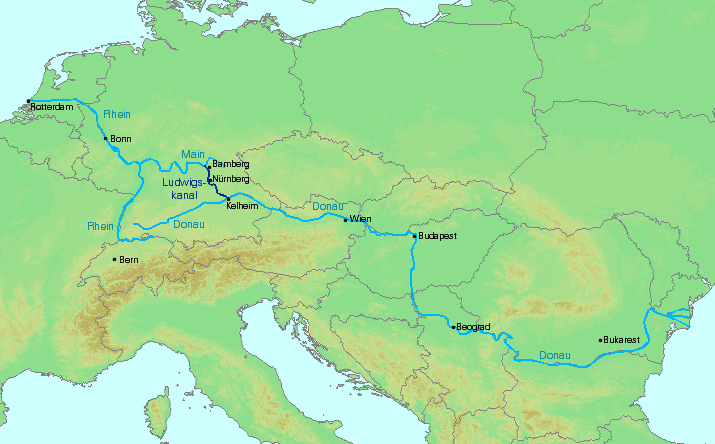
美因—多瑙河運河(德語:Main-Donau-Kanal;英語:Main–Danube Canal)位於德國東南部,是一條透過萊茵河東岸最大支流美因河連通多瑙河的人工水道。北起美因河畔班貝格,南至多瑙河畔凱爾海姆,長171公里。1992年7月31日正式通航。運河連接了歐洲大陸上的萊茵河和多瑙河兩大水系,縮短了北海與黑海之間的內河航程,對東、西歐間的貨運交通及歐洲內陸國的對外聯繫均具重要意義 (維基百科 – https://zh.wikipedia.org/wiki/美因-多瑙河运河)。
After the city tour of Nuremberg, we went taken back to the ship for lunch. There were optional tours in the afternoon for some and shuttle bus for those who wanted to have free shopping time in Nuremberg. Meanwhile, our ship continued to climb up to the summit of of the canal. We were given an introduction to the Rhine-Main_Danube Waterway and the Main-Danube Canal, it was a good talk and very educational, photos (shown below) were presented to allow us to see how the locks work. Built with reinforced concrete and with steel lock gates, today’s lock heights extended to approximately 30 meters. Yes, we’ve learned something new everyday !
The Rhine–Main–Danube Canal (German: Rhein-Main-Donau-Kanal; also called Main-Danube Canal, RMD Canal or Europa Canal), in Bavaria, Germany, connects the Main and the Danube rivers across the European Watershed, running from Bamberg via Nuremberg to Kelheim. The canal connects the North Sea and Atlantic Ocean to the Black Sea, providing a navigable artery between the Rhine delta (at Rotterdam in the Netherlands), and the Danube Delta in south-eastern Romania and south-western Ukraine (or Constanța, through the Danube–Black Sea Canal). The present canal was completed in 1992 and is 171 kilometres (106 mi) long (Wikipedia –https://en.wikipedia.org/wiki/Rhine%E2%80%93Main%E2%80%93Danube_Canal).
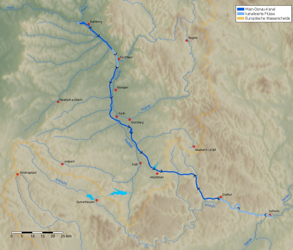
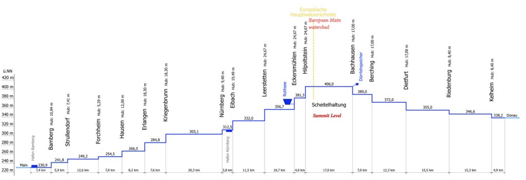
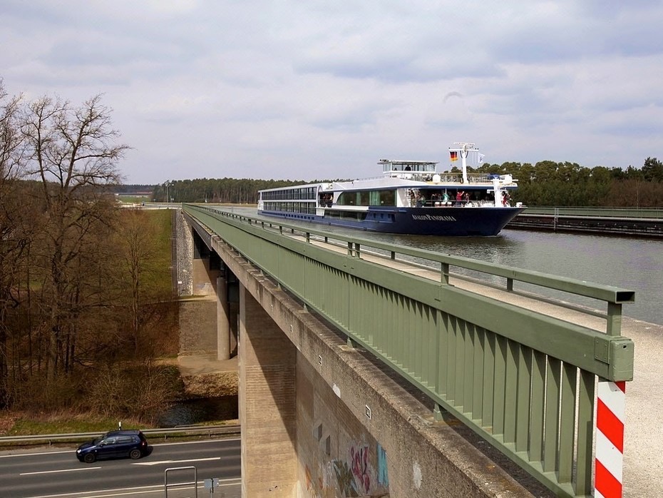
維基百科的資料,美因-多瑙訶的剖面圖顯示自紐侖貝格至分水嶺最高點,我們要過六個水閘,每一個水閘的深度由~20米至24.7米。另外,大家都知道有一段運河會在高於公路上行進,所以很多人就坐在休息大堂中等候,突然,有人說,”我們下面有公路和車子呀”, 大家怱怱跑出去見識這奇景。
As shown in the profile above, we had passed 6 locks since Bamberg, and 4 more to go, the depth of the last four locks from Nuremberg to the summit of the canal are pretty deep, between ~20 – 24.7 m high. Near the town of Neuses, out of the blue, we found ourselves on top of a freeway, we could see the headlights of the cars down below.
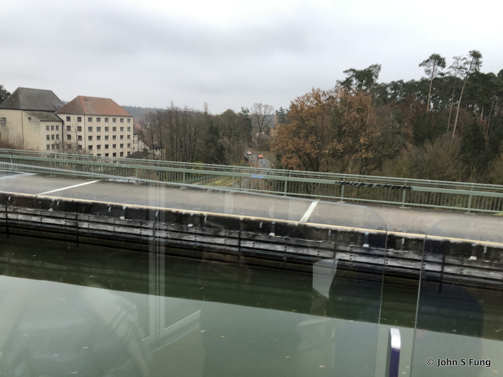
舉起手機,也只能紀錄到上面這樣。下圖是Viking 給的圖片,非常清楚示出陸上行舟的廬山真面目。
The photo below, provided by Viking, shows what it is like when the long ship is passing a highway, from the perspectives of those who are standing ashore.
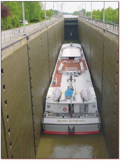
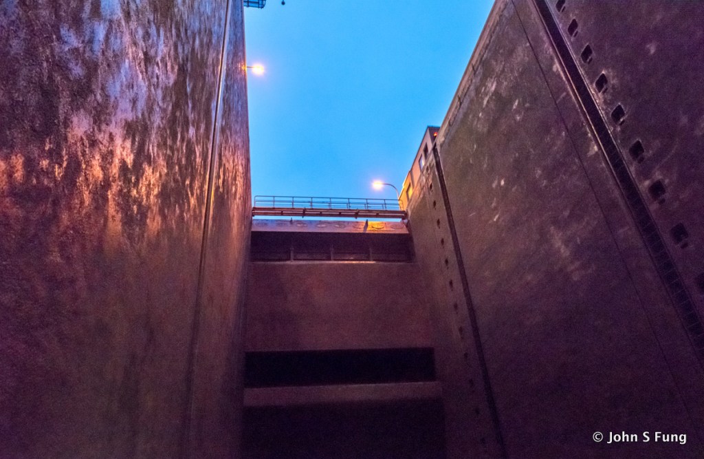
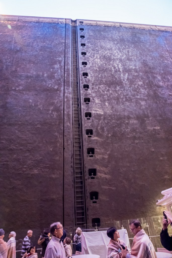
上圖,從岸上往下看 Viking 長船過水閘的情景。下圖是我們在船上往上看的感覺。
Photo provided by Viking Cruise to show how passing a deep lock is like 👆when looking down from above.
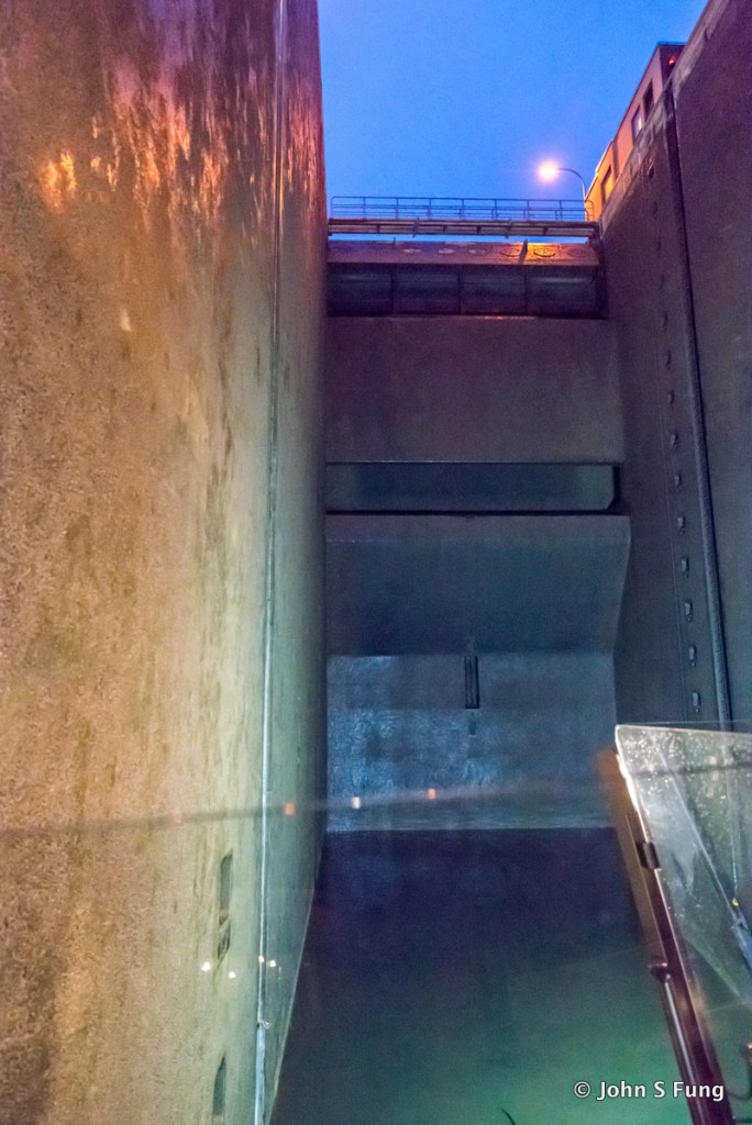
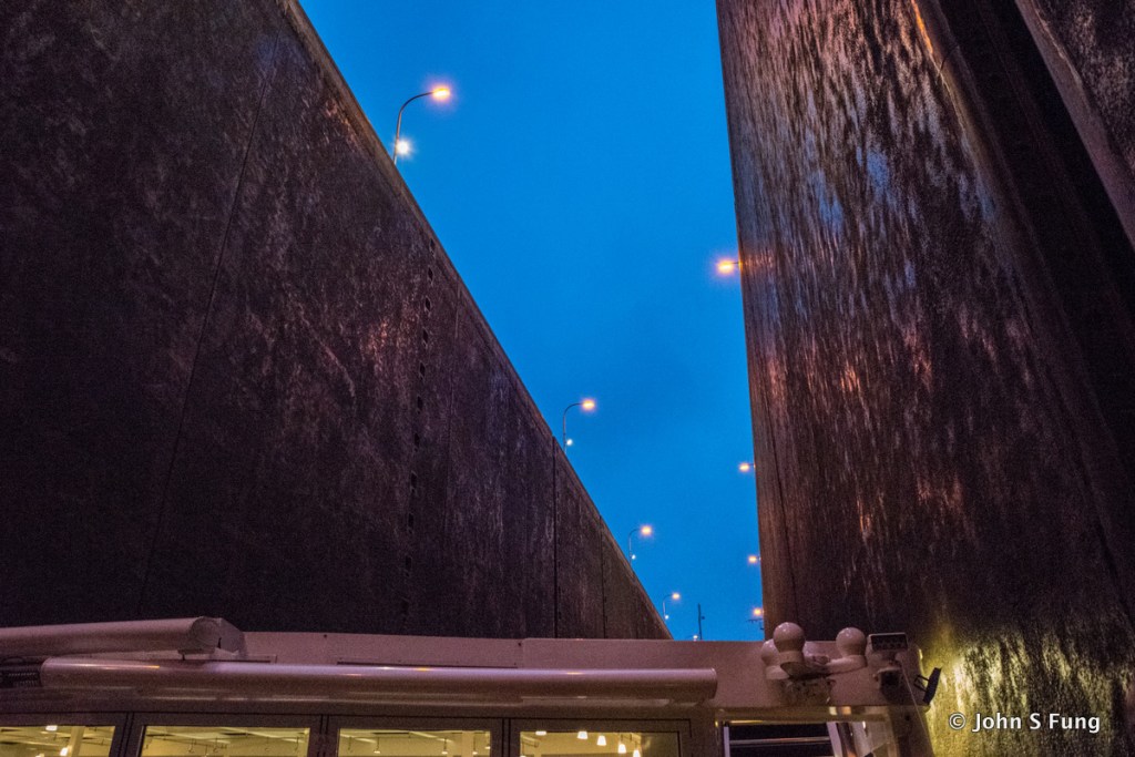
當時是下午4:45分,還不是最後一個水閘,不過,連續幾個水閘都有 20-25 米的深度。
This is 👆 what we see from our perspective on the deck, we were passing one of those 20 m deep locks after Nuremberg heading up to European Continental Divide. The time was 4:45 pm.
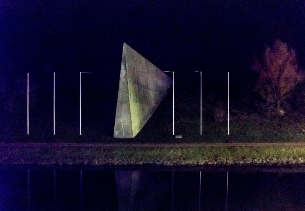
我們吃過晚餐,再到船頭去等越過運河的最高點。到了晚上8:54分我們終於來到標示分水嶺的紀念碑,也就是運河的最高點。理論上,雨水下在碑的兩邊會分別流向西入北海或向東流入黑海。
We passed the Summit of Main-Danube Canal at 8:54pm that evening, as marked by this European Continental Divide Monument, located in Hilpoltstein.
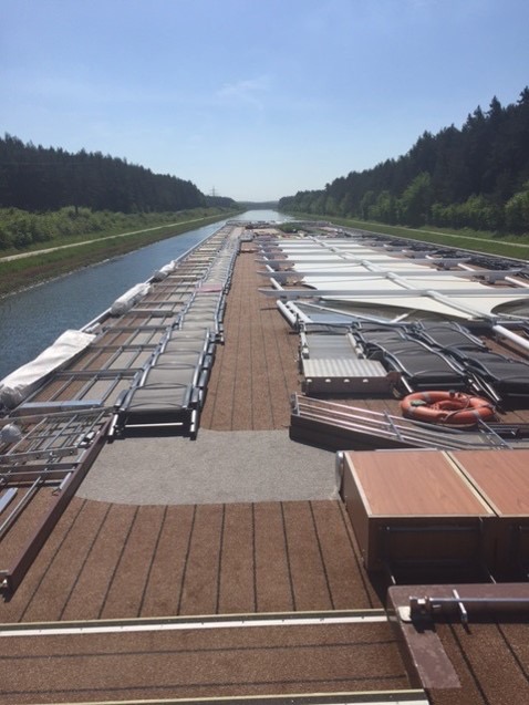
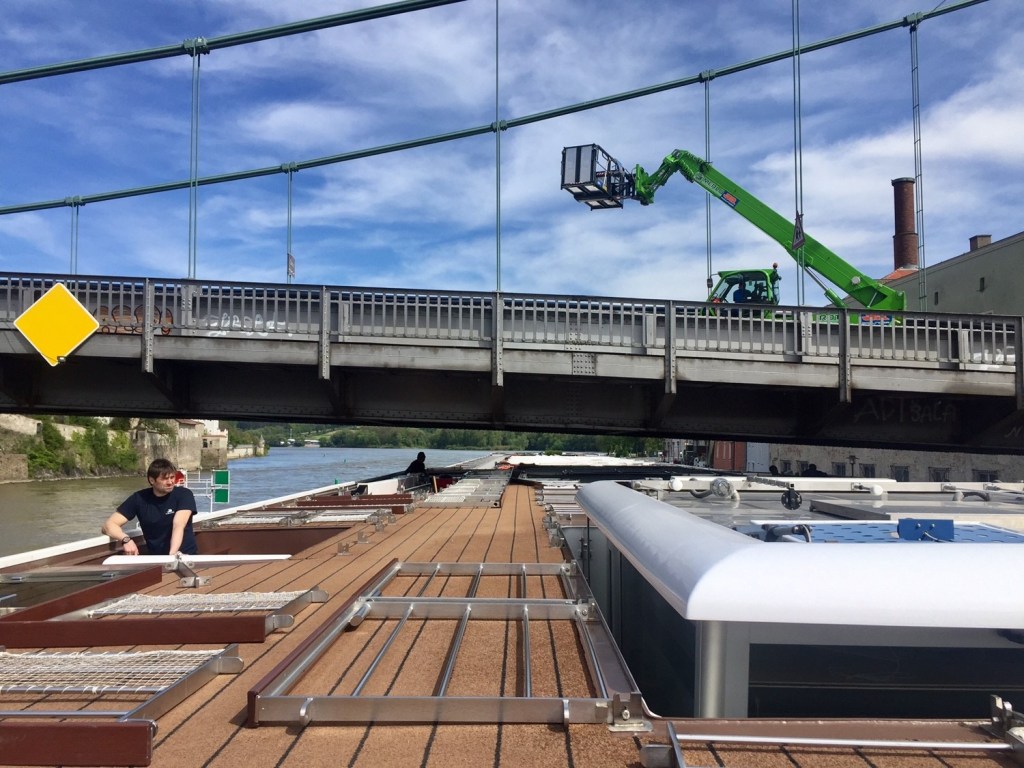
順便一提,河運水位的高低常會影響河輪的前進。水太高,船會碰到橋 ; 水太低,會過不了淺灘。我們全程算是幸運,除了有一段因水位高,不能上陽台甲板外,行進順利,不用巴士接駁換船。下面的圖顯示陽台甲板的應變舉措。
I was told that we had been lucky that we didn’t have to deal with the problems created by extreme low water or extreme high water level that requires bus transfer to another ship. Actually we had high water issue for days, crews had to collapse the whole sundeck, as shown below, and we were not allowed to go up there.